June 24, 2022 - Fly Home from Ohio
|
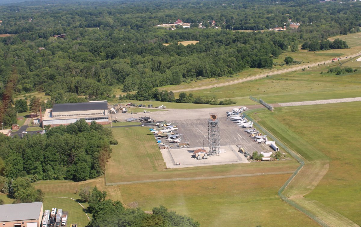
| Parked on the ramp at Akron-Canton Regional Airport. |
| |
 |
|
|
Hanging out in the luxurious upscale FBO. A lot of big private jets and turboprops come in here.
|
| |
 |
|
| A big private jet taxiis by as I do my preflight. |
| |
 |
|
|
Akron-Canton Regional has Class C airspace so I had to talk to Clearance Delivery, then Ground, then Tower, then Departure Control after takeoff. I managed to do it without embarassing myself too much. I'm sure it doesn't take them long to know that I'm not a professional pilot.
Right after takeoff I looked down and saw the MAPS Air Museum. I could have toured it yesterday but after having just seen the Air Force Museum, I was air museumed out.
|
| |
 |
|
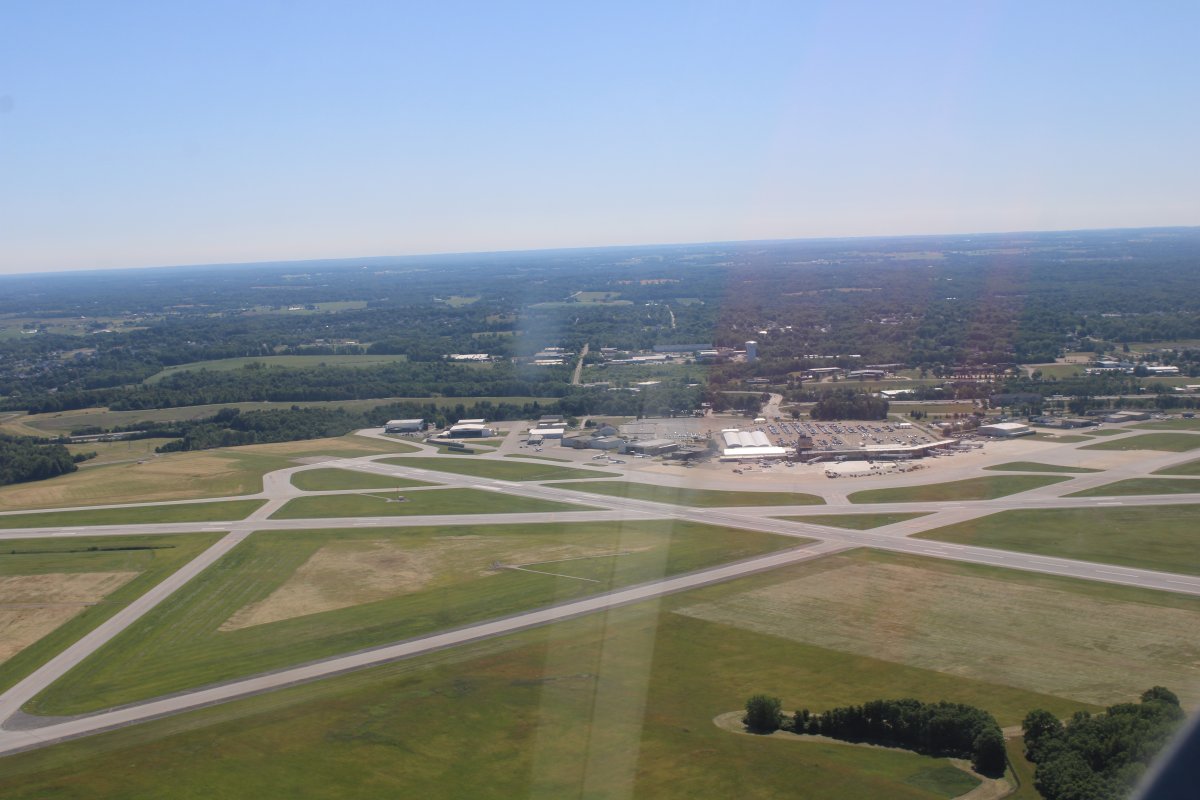
| Looking back at Akron-Canton Regional. |
| |
 |
|
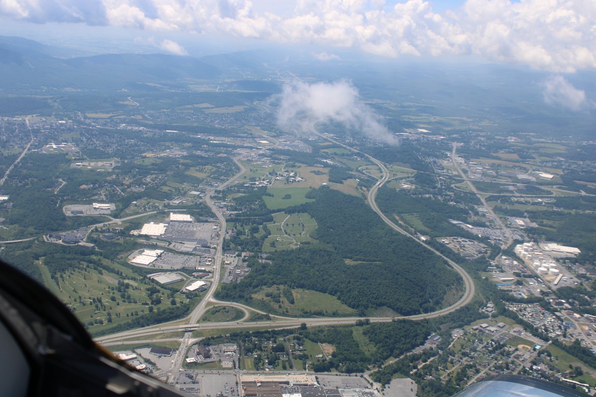
| Just north of Akron-Canton Regional is Akron-Fultion International with it's big airship hangar identical to Hangar One at Moffett Field, California. The Goodyear blimp was even floating around, seen at upper right. Surprisingly Akron-Canton doesn't have a tower. I thought about keeping my plane there overnight but in the end went with Akron-Canton because of the ease in renting a car. |
| |
 |
|
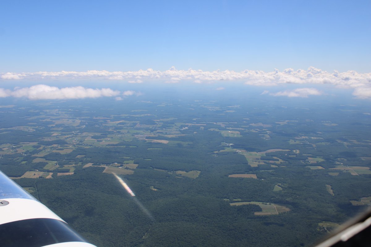
| Heading northeast. I was surprised at how wooded north-east Ohio is. |
| |
 |
|
|
Passing by Braceville Airport (41N)
|
| |
 |
|
| Passing by Warren Airport (62D). As you can see, Warren has a nice long, wide turf runway. And a narrow asphalt one too. |
| |
 |
|
|
Approaching Mosquito Creek Reservoir which runs north to south.
|
| |
 |
|
| Passing by Youngstown/Warren Regional (KYNG) to the south. |
| |
 |
|
| Looking north up the reservoir. |
| |
 |
|
| A railroad points straight as an arrow to the north. |
| |
 |
|
|
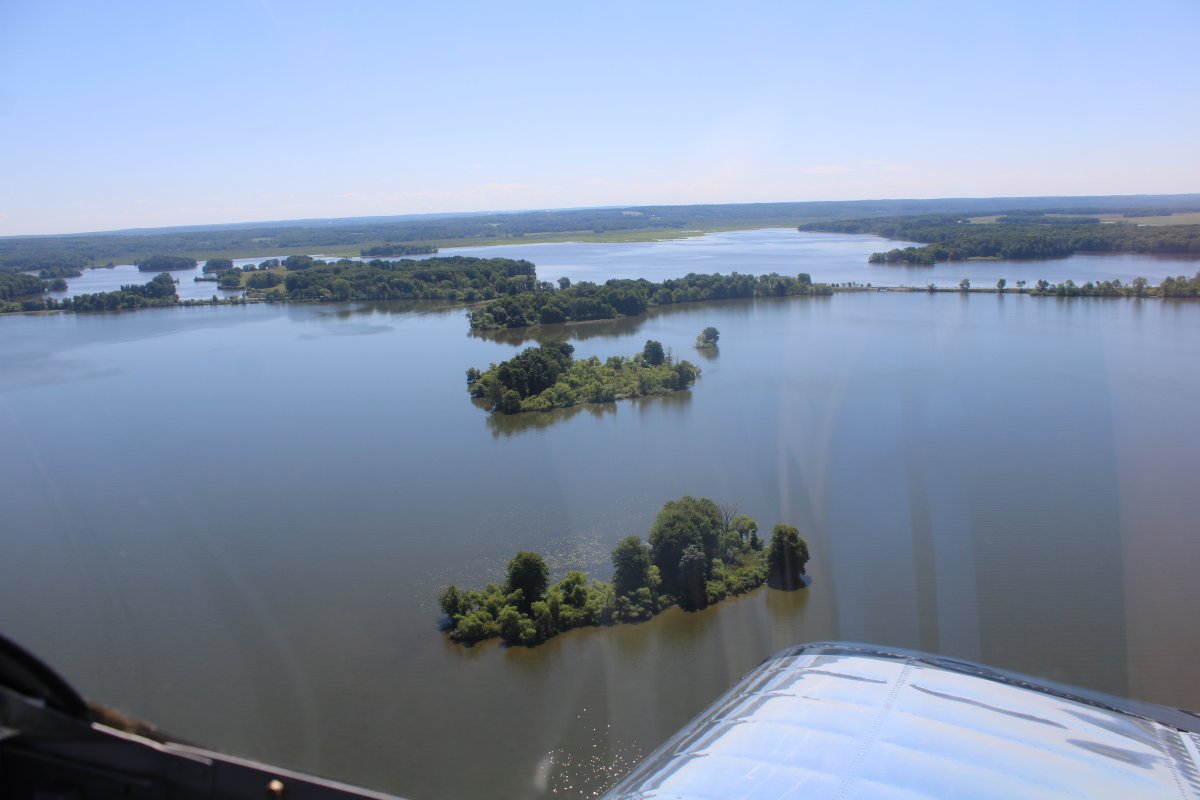
Pymatuning Reservoir stretches north and then dog legs to the east.
|
| |
 |
|
| Rounding the northern bend. |
| |
 |
|
| Looking east-southeast. |
| |
 |
T |
| The reservoir turns to marsh at its southeastern end. |
| |
 |
|
|
I descend to take a closer look.
|
| |
 |
|
| Passing over little Conneaut Lake. |
| |
 |
|
|
Flying alongside Port Meadville Airport (KGKJ).
|
| |
 |
|
| Northwest Pennsylvania is heavily wooded as well. |
| |
 |
|
|
Passing by Titusville Airport (6G1).
|
| |
 |
|
| A little to the east is the town of Titusville. |
| |
 |
|
| A motel is Titusville where your room is a railroad car. |
| |
 |
|
| Looking down sun back west at Titusville. The picture quality is much better. |
| |
 |
|
|
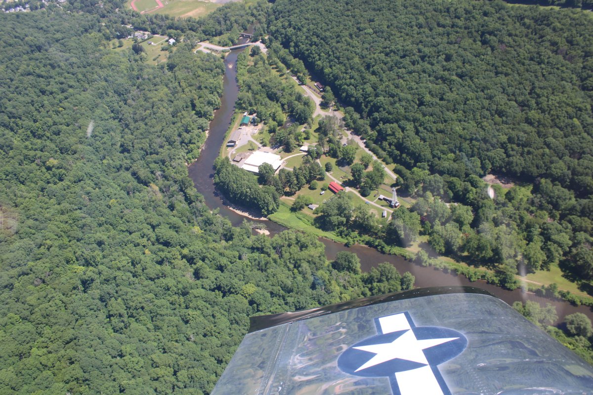
And there is what I came to see: the birthplace of the American oil industry. It was down below that on August 27, 1859, that Edwin L. Drake and William A. Smith drilled the first oil well in history.
|
| |
 |
|
| From another angle. The area in the bend in "Oil Creek" is Drake Well Museum and Park. The large building with the white roof is the Drake Well Museum. I know because Lynnette and I visited here last October. Link. |
| |
 |
|
|
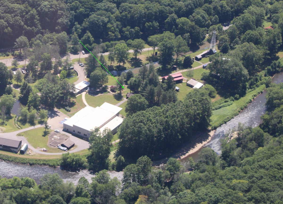
The green arrow points to the replica of the Drake Oil Well. It is hallowed ground, where world history was made. In my opinion it's right up there Sutter's Mill in Columna, California where John Marshall discovered gold in 1848, Promontory Summit, Utah where the first transcontinental railroad was joined in 1869, and Kitty Hawk, North Carolina where the Wright Brothers made man's first powered flight on December 17, 1903.
|
| |
 |
|
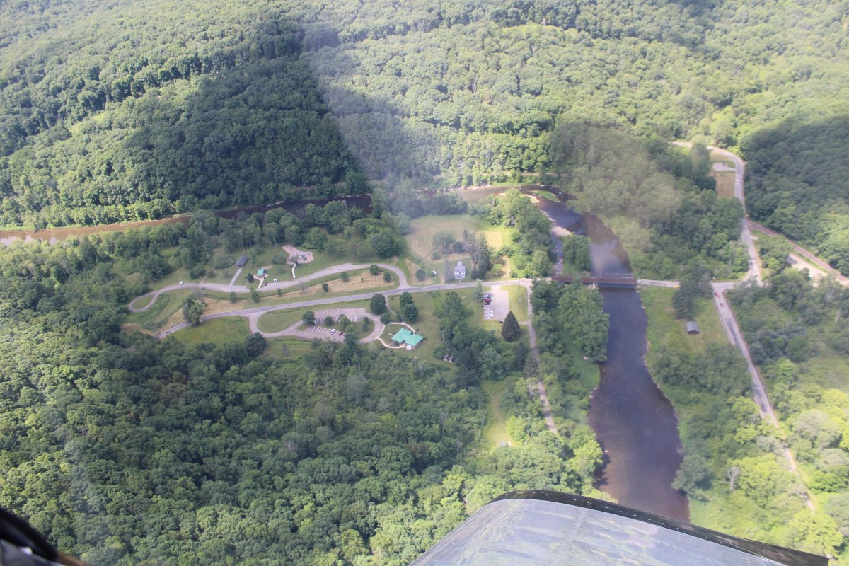
| I decided to follow Oil Creek from Titusville 14 miles south to the appropriately named "Oil City". |
| |
 |
|
| Oil Creek runs through Oil Creek State Park. |
| |
 |
|
| Even though you can't see the creek in the top half of the picture, you can still it snaking through the hills by the tree gap. |
| |
 |
|
|
Notice the railroad tracks to the left of Oil Creek. You can take a scenic ride these rails on the Oil Creek & Titusville Railroad. Lynnette and I couldn't do it last October because it was closed for the season. I'd like to do it someday. It's supposed to be spectacular in the fall.
|
| |
 |
|
| A solitary house sits in a clearing in the middle of an unbroken forest. I've heard there are more trees in America now than there were when Columbus discovered the new Continent. After what I've seen from the air, I believe it. |
| |
 |
|
|
Continuing down Oil Creek.
|
| |
 |
|
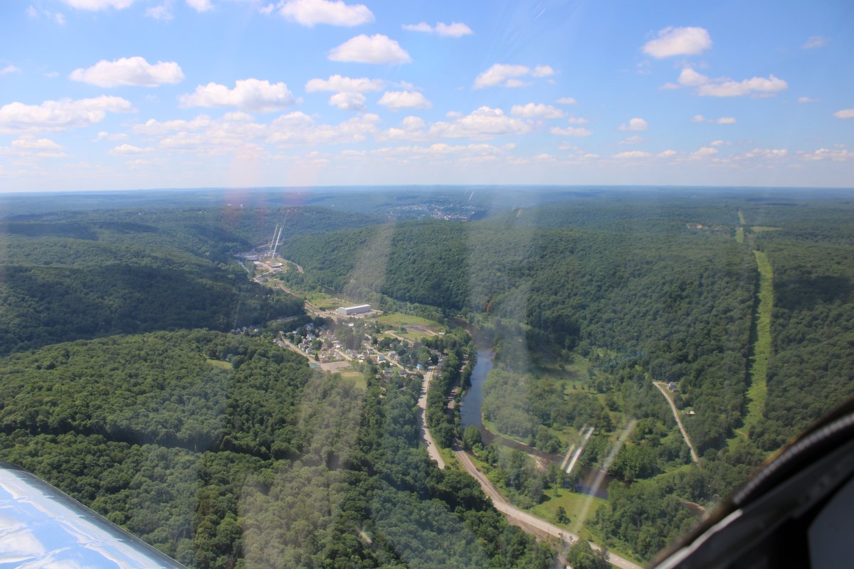
| After about ten miles or so I encounter some civilization. Looks like a park area. |
| |
 |
|
| More civilization includingt houses. |
| |
 |
|
|
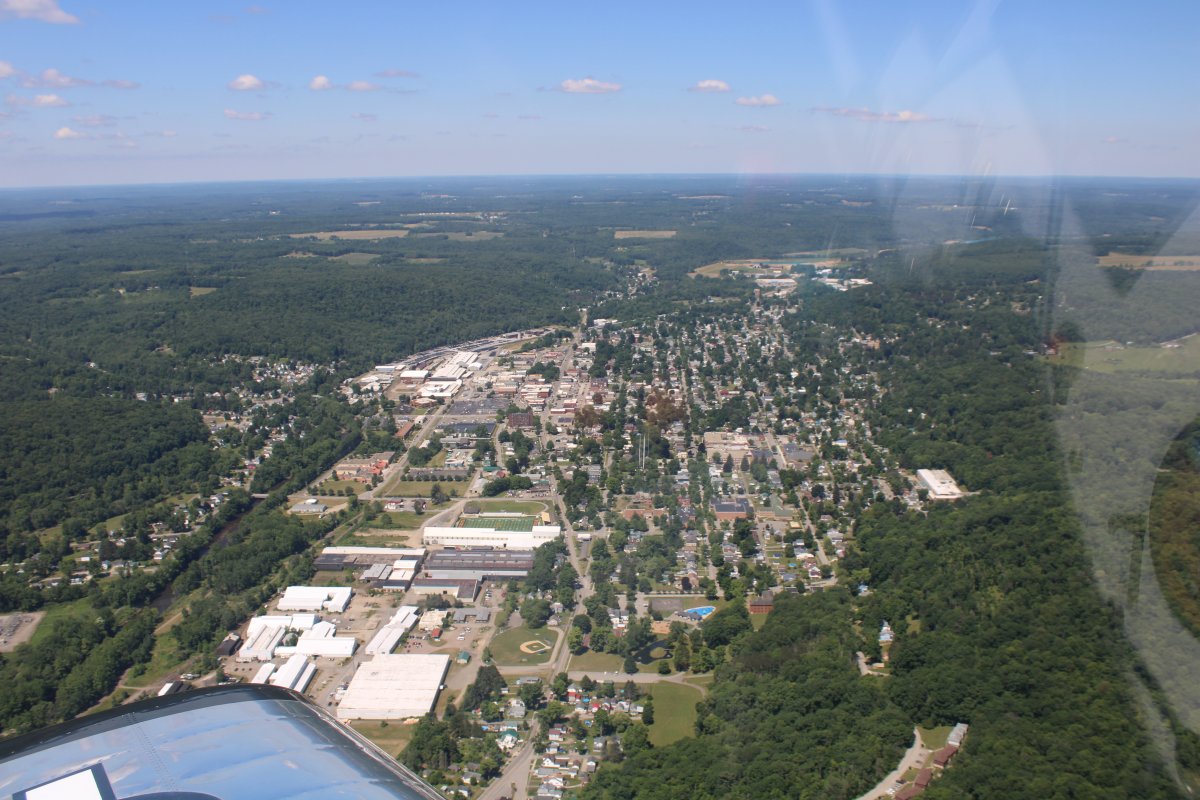
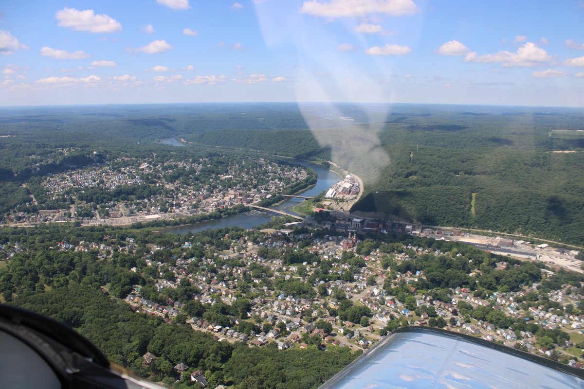
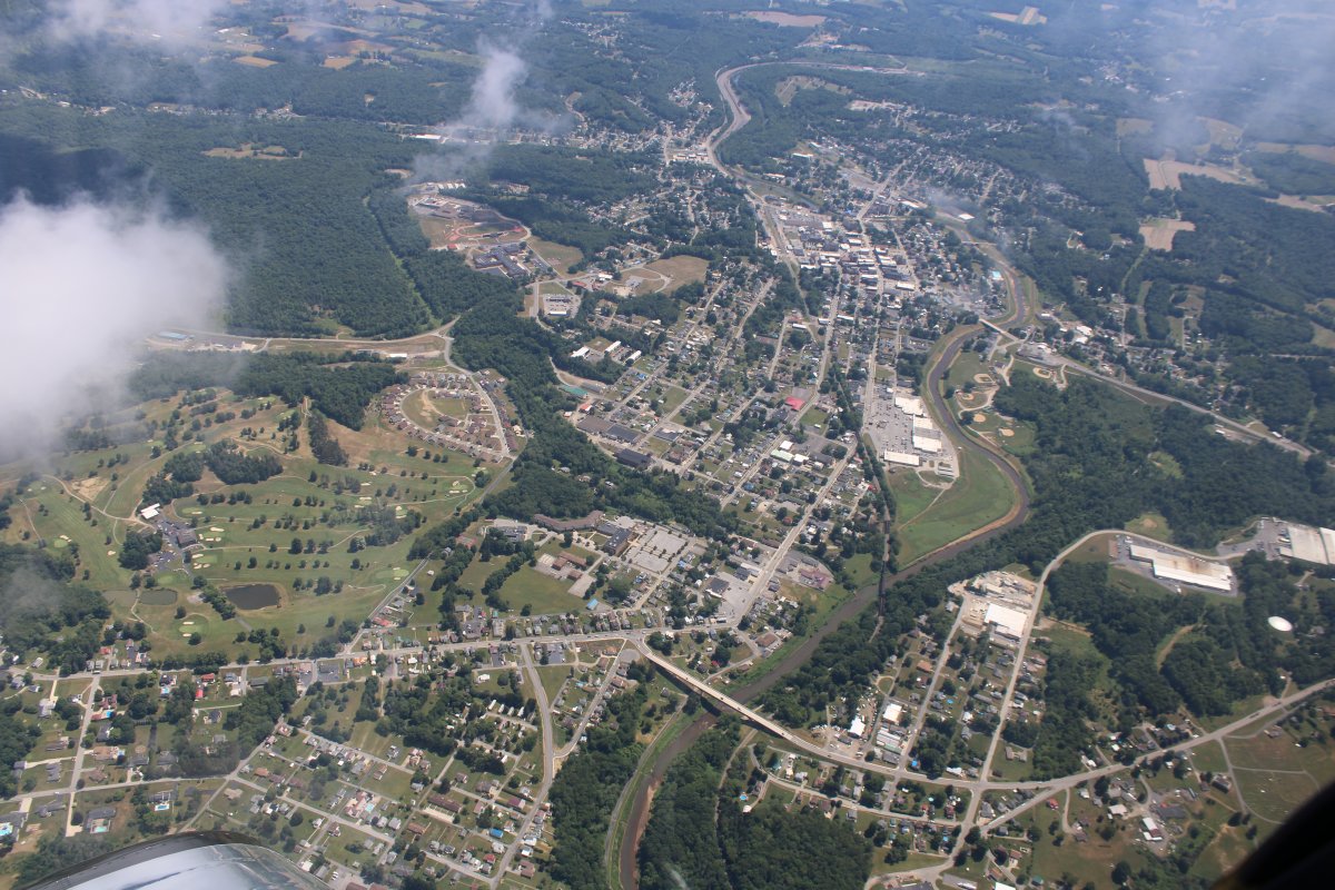
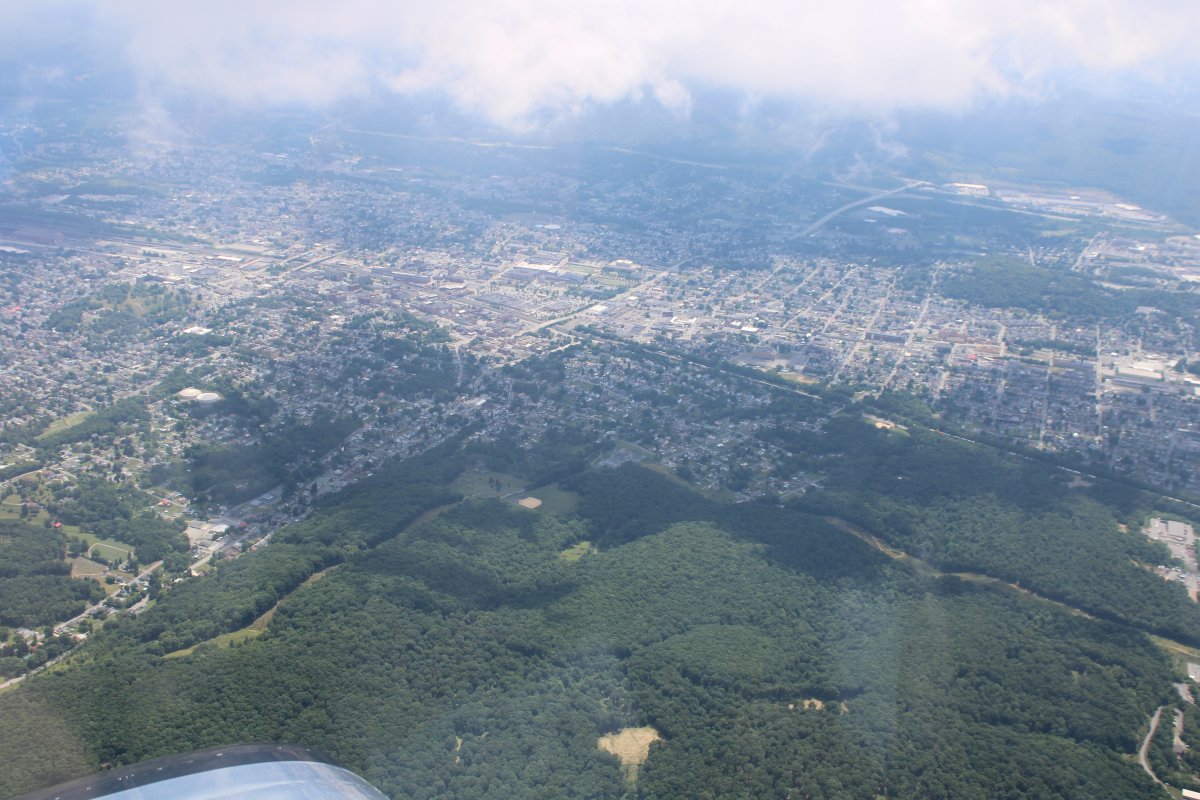
And then I come to the appropriately named Oil City, located at a bend in the Allegheny River at the mouth of Oil Creek.
Oil City was one of the boomtowns founded Drake drilled the first oil well in 1859. By 1860, the oil trade was far and away the dominant industry in the Oil City area.
|
| |
 |
|
|
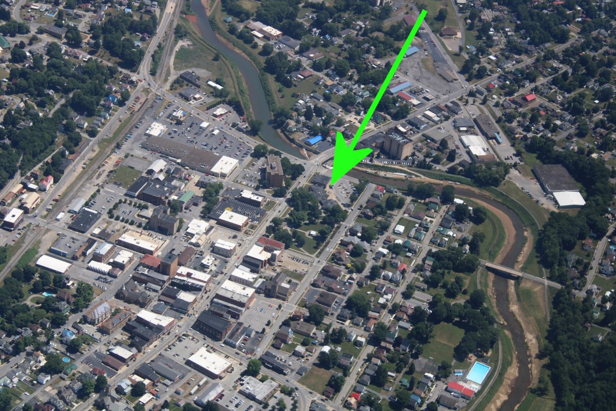
One famous person who hailed from Oil City, Pennsylvania was Francis "Gabby" Gabreski – the American fighter ace during World War II and a jet fighter ace during the Korean War. Gabreski was one of seven US pilots who were aces in both World War II and Korea. Gabreski was the leading US ace in Europe with 28 confirmed kills.
|
| |
 |
|
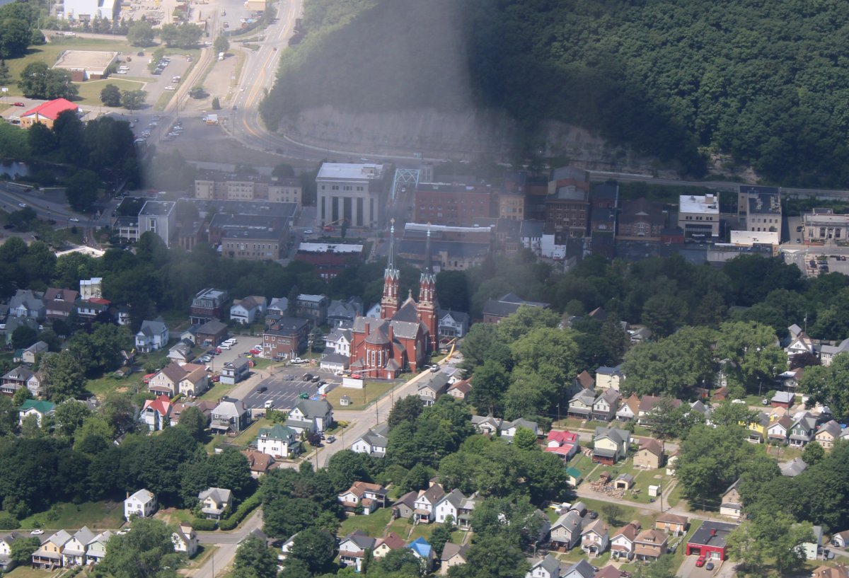
| The St. Joseph church really stands out from the air. |
| |
 |
|
|
After Oil City, I climbed and headed east-southeast direct for home.
|
| |
 |
|
| Passing by Clarion County Airport (KAXQ). |
| |
 |
|
|
On the chart, I noticed that I would be passing close to Punxsutawney. So I deviated slightly to pass over the Pennsylvanian town. Why? Because Punxsutawney is known for its Groundhog Day celebration each February 2, during which thousands of attendees and international media outlets visit the town for an annual weather prediction by the groundhog Punxsutawney Phil, of course.
Below is the town of Punxsutawney.
|
| |
 |
|
|
I wasn't sure where to look for the Groundhog Festival site. All I had to go on was what I remembered from the Bill Murray movie Groundhog Day. The green arrow points to where I think the annual festival is held. I checked when I got home and I was right. That is Barclay Square and is where the annual festival is held.
Jonah Goldberg wrote this great review on the movie Groundhog Day: Link. I encourage you to read it. Here's a sample:
"Here’s a line you’ll either recognize or you won’t: “This is one time where television really fails to capture the true excitement of a large squirrel predicting the weather.” If you don’t recognize this little gem, you’ve either never seen Groundhog Day or you’re not a fan of what is, in my opinion, one of the best films of the last 40 years. As the day of the groundhog again approaches, it seems only fitting to celebrate what will almost undoubtedly join It’s a Wonderful Life in the pantheon of America’s most uplifting, morally serious, enjoyable, and timeless movies.
|
| |
 |
|
|
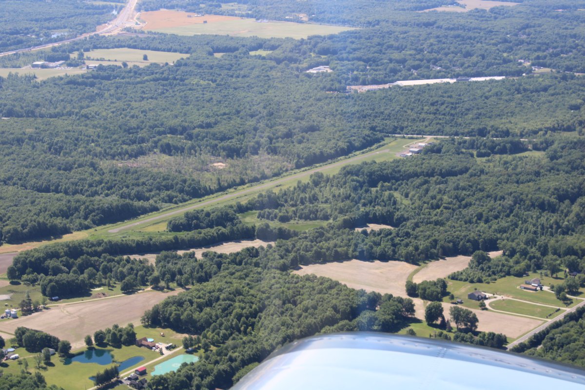
Punxsutawney Airport on the northeast side of town.
|
| |
 |
|
|
Passing by Glendale Lake.
|
| |
 |
|
|
A bunch of windmills on the ridge west of Altoona. Only three of them were turning.
|
| |
 |
|
| Passing by the city of Altoona. |
| |
 |
|
|
Another look from the south.
|
| |
 |
|
|
ZZZ
|
| |
 |
|
| I approached a long, squiggley lake running north to south. Here I'm looking south at Raystown Lake. |
| |
 |
|
|
And looking north at Raystown Lake.
|
| |
 |
|
|
Passing by a small restricted area near Chambersburg, PA off my right wingtip. I wonder what it is. Must be under that mountain.
|
| |
 |
|
| Passing by Franklin County Regional Airport which serves Chambersburg, PA. |
| |
 |
|
|
Looking down at Gettysburg Airport.
|
| |
 |
|
|
Approaching the Gettysburg battlefield.
|
| |
 |
|
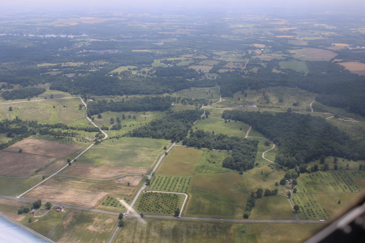
| Looking at the Union left wing: Little Round Top, Big Round Top, Devil's Den and the Peach Orchard. |
| |
 |
|
|
Now looking at the Union Center: Cemetery Ridge.
|
| |
 |
|
|
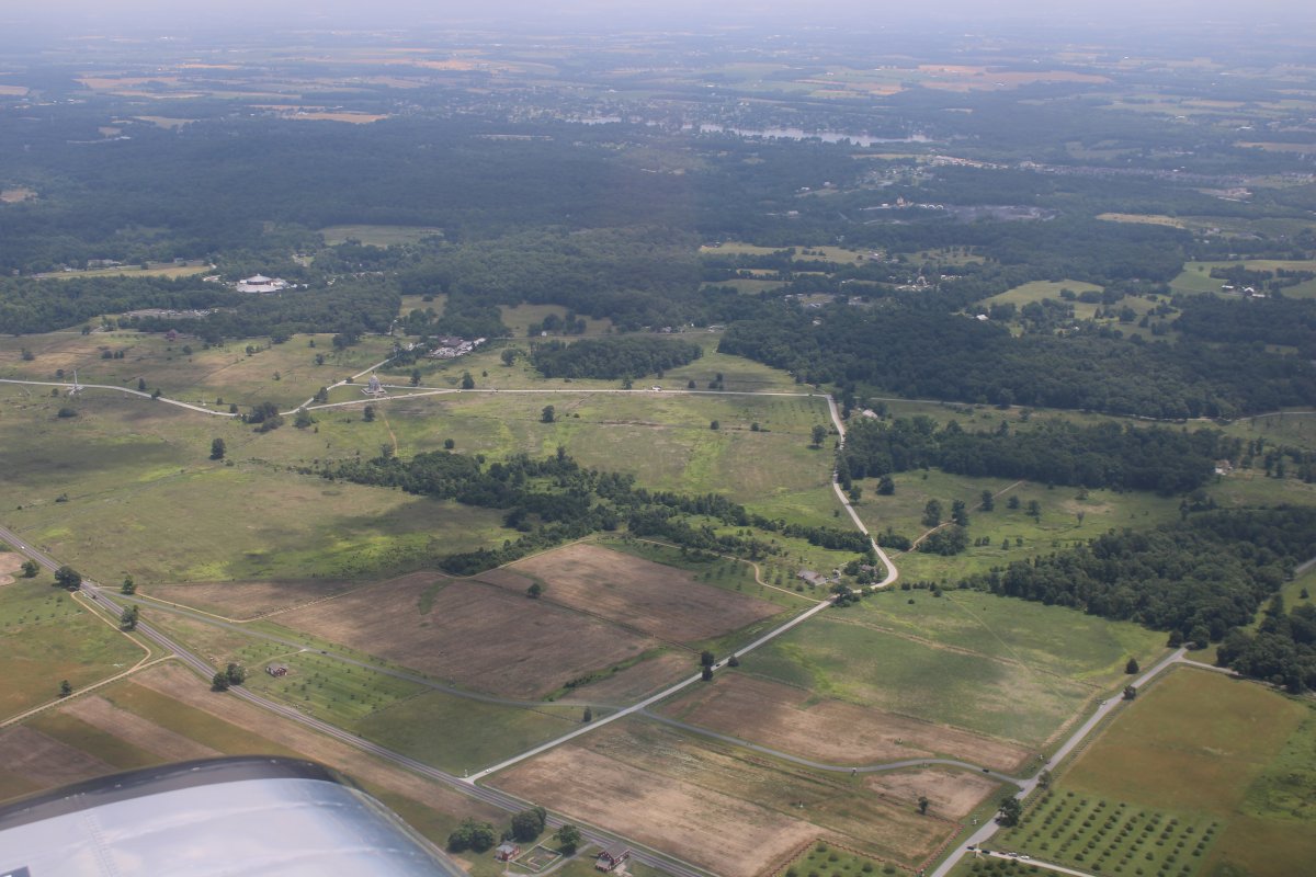
Now looking at the Union right: Cemetery Hill, Culp's Hill, and the town of Gettsyburg on the far left. The visitor's center is seen just right of center in the background.
The road just off my wingtip is Emmitsburg Road. You can see "The Angle" if you know where to look.
|
| |
 |
|
| Gettysburg is at the top of the image. Seminary Ridge runs top to bottom where that forested area is on the left. |
| |
 |
|
|
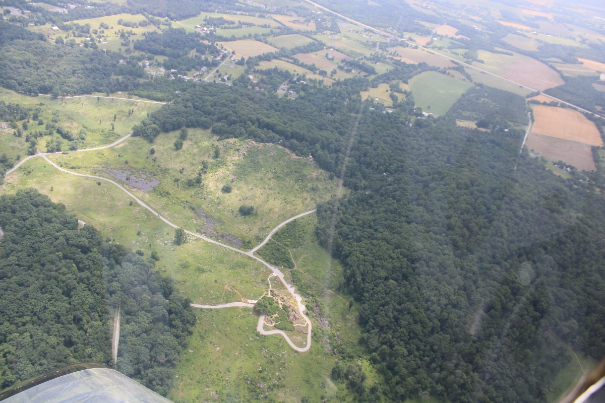
Little Round Top at center top, Big Round Top at right, and the Devils Den that rocky area at center bottom.
|
| |
 |
|
|
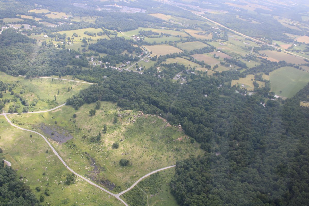
Close up of Devil's Den.
|
| |
 |
|
| Little Round Top at center. |
| |
 |
|
|
Looking north down Cemetery Ridge and the Taneytown Road to Gettysburg.
|
| |
 |
|
|
Passing by Carroll County Airport (KDMW). I'll be there tomorrow, at the Mid-Atlantic RV Fly-in.
|
| |
 |
|
|
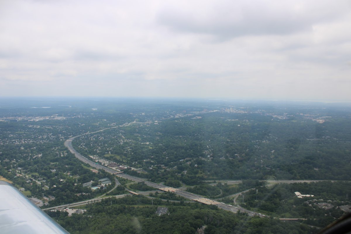
About to cross I-695 -- the Baltimore beltway -- near Owings Mills. Towson is in the distance, right of center.
And so ends a mini-cross-country flight.
|
| |
 |
|
| |
| |
|
|
|
|
|
|